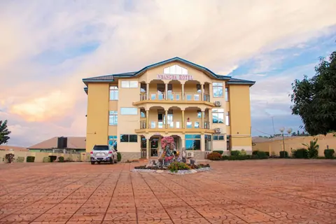
 ★★★ 3-star
Region · capital Techiman
Hotels in Bono East Region
Bono East sits in the middle of Ghana, a farming region of yam markets, river crossings and quiet roads. Techiman is the capital and the practical base for most stays.
IMPT Ghana editorial team · Reviewed 13 November 2026

At a glance
- Capital
- Techiman
- Region
- Middle Ghana, inland
- Main approach
- Kumasi, about 105 km
- Best months
- November to February
The character of Bono East
Bono East was carved out of the old Brong Ahafo area and became one of Ghana's sixteen regions in 2019. It lies inland, north of Ashanti and south of Savannah, on the road corridor that links Kumasi with Tamale. The land is mostly rolling guinea savannah and farmland, with shea and cashew trees, yam mounds and maize fields running to the horizon. It is not a region built around tourism, and that shapes the kind of stay you will find: practical town hotels serving travellers, traders and public servants rather than resort properties.
Techiman is the capital and by far the largest town, a busy commercial centre with one of the biggest periodic markets in West Africa. Kintampo, north on the same road, is smaller and known for its waterfalls and the road junction where routes to Tamale and to Wa divide. Other district capitals include Atebubu, Nkoranza, Pru, Sene East and Kintampo North. Travellers usually pass through on the way north, or stop for a night or two to break a long journey.
Tip: Fuel up in Techiman or Kintampo before heading further north; filling stations thin out on the quieter stretches.
Main towns and what to see
Techiman revolves around its market, which runs on a six-day cycle and draws traders from across the region and beyond. It is a place to see yam, maize, legumes, shea nuts and livestock change hands, and to eat plainly and well. The town also has a large central mosque and a lively lorry station, and it makes a sensible base for exploring the surrounding districts by day.
Kintampo is the other name most visitors know, chiefly for Kintampo Falls, where the Pumpum river drops through forest a short drive from town. The wider region rewards slow travel: farming villages, river crossings on the Volta tributaries, and quiet roads where the main interest is the landscape itself. Nkoranza has a royal and traditional history worth asking about locally, and Atebubu sits near the eastern edge of the region.
- Kintampo Falls, the region's best-known natural sight, a short drive from Kintampo town.
- Techiman's periodic market, held on a six-day cycle, for produce, cloth and everyday goods.
- The Kumasi to Tamale road, which crosses the region and makes stopovers easy to plan.
- Shea and cashew farmland on the back roads, best seen with a local guide.
Tip: Market days move on a six-day cycle rather than a weekday, so ask locally which day falls during your stay.
Getting there and around
There is no airport in Bono East. Most visitors arrive overland from Kumasi, which is about 105 km south of Techiman on a good tarred road, or from Tamale to the north. Kumasi has the nearest airport, Prempeh I International Airport, and the drive from there to Techiman takes a couple of hours depending on traffic leaving the city. Long-distance coaches run between Kumasi, Techiman, Kintampo and Tamale, and shared minibuses, known as trotros, cover the shorter legs.
Within the region you will rely on trotros, shared taxis and, for the falls and villages, a hired car with a driver. Roads between the main towns are generally sealed, but the smaller routes can be rough in the rains. Road travel after dark outside towns is best avoided, in line with UK Foreign Office advice for Ghana. If you plan to continue north, Techiman and Kintampo are natural places to break the journey rather than push straight through.
Tip: Allow more time than the map suggests, and plan to reach your hotel before dusk rather than driving unlit roads at night.
When to visit
Bono East sits in the northern climatic band, with one rainy season that runs roughly April to mid-October and peaks around August and September. The dry months from November to March are the easiest for travel, with clear roads and comfortable heat. The harmattan, a dry dusty wind, blows roughly December to March and is strongest in the north, so expect hazy skies and cooler mornings in January and February.
The rains bring the region to life: green farmland, full rivers and dramatic skies around Kintampo Falls, which are at their most impressive when the water is high. Travel is slower then, and some smaller roads become difficult. Whatever the season, check the forecast and road conditions locally before setting out, and confirm opening arrangements for the falls with the Ghana Tourism Authority or a local contact.
- November to February: dry, dusty and the easiest months for road travel.
- March to mid-October: the wet season, green landscape and strong waterfall flow.
- August and September: the wettest stretch, with the slowest roads.
- December to February: harmattan haze, cooler mornings and reduced visibility.
How to choose where to stay
Almost every stay in the region is in Techiman or Kintampo, so the first decision is which town suits your route. Techiman has the widest choice, the most services and the best transport links, which makes it the obvious base if you want to explore in several directions. Kintampo suits anyone whose priority is the falls, or who wants a shorter drive onward to Tamale. Smaller district capitals have very limited accommodation and are best treated as day visits.
When you compare places, weigh the practical things: reliable power and water, air conditioning or a fan, secure parking if you are driving, and whether meals are served on site or you will need to eat out. Ask directly about backup power and water storage, since supply can be interrupted. Confirm the current rate and cancellation terms before you commit, and check that the address matches the town you intended.
Tip: Ask whether the room rate includes breakfast, and whether the hotel runs a generator, before you book in a smaller town.
Where to stay
Hotels in Bono East Region
2 stays with a guest score or a four- or five-star rating in the IMPT database, five-star first, then four-star, then the rest by the booking supplier's guest score. Prices and availability are live in the IMPT app.
★★★ 3-star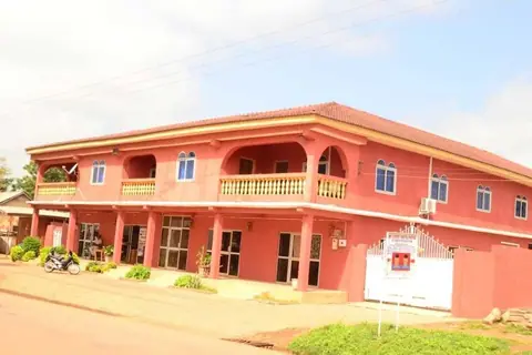 ★★ 2-star
More places to stay
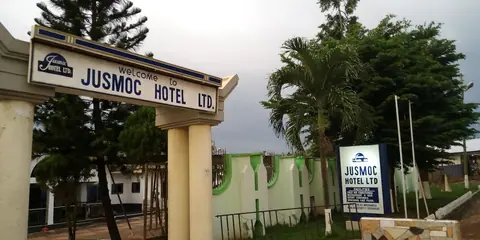
Further listings in the IMPT database with fewer details from the booking supplier (no guest score yet). Check them on the property's page before you book.
Bono East Region: questions
Where is the capital of Bono East Region?
Techiman is the capital of Bono East Region and its largest town. It lies inland in the middle of Ghana, north of Kumasi and south of Tamale, on the main road corridor between the two. Most accommodation in the region is found here, and it is the most practical base for exploring the surrounding districts.
How do you reach Bono East Region from Kumasi?
The usual route is overland. Techiman is about 105 km from Kumasi on a tarred road, and the drive takes a couple of hours depending on traffic leaving the city. Long-distance coaches and shared minibuses run the route. The nearest airport is Prempeh I International Airport at Kumasi; there is no airport inside Bono East.
Is there an airport in Bono East Region?
No. Bono East has no airport, so visitors arrive by road. The closest airport is Prempeh I International Airport at Kumasi, roughly 105 km from Techiman. From there you continue by coach, shared minibus or hired car. Check current schedules with the operator on the ground, since services change.
What is there to see near Kintampo in Bono East Region?
Kintampo Falls is the best-known sight in the region, where the Pumpum river drops through forest a short drive from Kintampo town. The flow is strongest in the wet season. Around it are farming villages and quiet back roads. The falls are the main reason many travellers stop in the region rather than pass straight through.
When is the best time to visit Bono East Region?
The dry months from November to March are easiest, with clear roads and comfortable heat, though harmattan dust can haze the skies in January and February. The rainy season runs roughly April to mid-October, peaking around August and September, when the landscape is green and the falls are fuller but roads are slower.
What should you check before booking a hotel in Bono East Region?
Ask about backup power and water storage, since supplies can be interrupted. Confirm whether the room has air conditioning or a fan, whether meals are served on site and whether secure parking is available. Check the current rate and cancellation terms directly with the property, and make sure the address matches the town you intended to stay in.
Does Bono East Region have many places to stay?
Accommodation is concentrated in Techiman and, to a lesser extent, Kintampo and a few district capitals. Most properties are practical town hotels serving travellers, traders and public servants rather than resort-style stays. Smaller towns have very limited options, so plan to base yourself in one of the two main towns.
How do you get around Bono East Region without a car?
Shared minibuses, known as trotros, and shared taxis connect the main towns and their lorry stations. For sights such as Kintampo Falls or outlying villages, hiring a car with a driver for the day is the simplest option. Roads between the principal towns are generally sealed, but smaller routes can be rough in the rains.
Read next
Hotels in Bono RegionBono Region is working Ghana: cocoa farms, market towns and an administrative capital at Sunyani. This guide covers where to base yourself, how to arrive, when to travel and what to ask before booking a room.Hotels in Ashanti RegionAshanti Region is the old heart of the Asante kingdom, with Kumasi at its centre. This guide covers the region's towns, how to reach them and how to choose a base for a few days.Hotels in the Northern Region of GhanaTamale is the transport hub and the natural base for hotels in the Northern Region of Ghana. The rest of the region is savannah, farming towns and Dagbon royal history, best seen on day trips.
IMPT Ghana editorial team · Reviewed 13 November 2026. Hotels are placed by their own map pin inside Ghana's official district boundaries (Ghana Statistical Service). Facts checked against the Ghana Tourism Authority (visitghana.com), the Ghana Immigration Service and other official sources listed in our editorial policy. Prices are never shown: live rates open in the IMPT app.
Find a stay in Bono East Region
Photo credits: PeterEasthope, CC BY-SA 4.0, via Wikimedia Commons.